Category: Geography & Maps, Map, Photography
Results
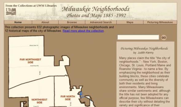
About the Collection Milwaukee and Art Work of Milwaukee Milwaukee Neighborhoods: Photos and Maps 1885 - 1992 presents images of Milwaukee neighborhoods from the Far Northwest Side to the Far South Side. The selection of images is limited by the current boundaries of the city of Milwaukee. The digital collection provides a visual documentation of the development of the city of Milwaukee from the mid-1880s to the early 1990s. It includes images of residential and industrial facilities, local businesses, historic buildings, churches, and numerous Milwaukee parks.

The Michigan County Histories and Atlases Digitization Project is comprised of 428 digitized titles (many composed of multiple volumes) published before 1923. The collection offers all members of the community free keyword searching and page-by-page access to digitized reproductions of Michigan county histories and atlases as a resource for historical and genealogical research. The collection is made possible, in part, through a generous Library Services and Technology Act (LSTA) grant. Additional funding was provided by Michigan Council of Library Directors institutions and a Michigan Digitization and Preservation for Access grant.