Geology & Earth Sciences

The fourth in a series of online collections from Harvard University, Expeditions and Discoveries delivers maps, photographs, and published materials, as well as field notes, letters, and a unique range of manuscript materials on selected expeditions between 1626 and 1953. The collection is made possible with the generous support of the Arcadia Fund . In the 19th and 20th centuries, Harvard University played a significant role—as underwriter, participant, collector, and repository—for pace-setting expeditions around the world. For Internet users, Expeditions and Discoveries provides selective access to Harvard’s multidisciplinary records of those expeditions.

Project Background This Pilot Project was first conceived in May 1999 to provide Web access to high use maps from the University of California-Berkeley's Earth Sciences and Map Library's collection. One-time funds were requested and received from the Library's collections budget to cover scanning and other project costs. The U.S. Geological Survey's topographic quadrangles of the San Francisco Bay region were selected for digitizing. These maps are in the Public Domain and have no copyright restrictions, plus the geographic area selected would be a high use to our primary clientele and of interest for off-site users. Access is provided to both the 15- and 7.5-minute USGS topographic quadrangles, spanning more than 100 years of mapping (1885-1999). Geographic coverage extends from Pt.
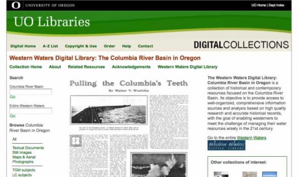
About - Columbia River Basin Project Background The University of Oregon Libraries are participating in a collaborative project to develop a digital collection of print, image, cartographic, and other format materials relating to the waters of the Western United States. The project is partially funded by a grant from the Institute of Museum and Library Services (IMLS) and is administered centrally by the Greater Western Library Alliance (GWLA) of which the UO Libraries are a member. The Western Waters Digital Library (WWDL) is a distributed collection of materials from research institutions in the Western United States of America.

DIGITAL COLLECTIONS About the Collection This collection contains 210 selected digital images and 3 digital videos from an archived community collection devoted to documenting one of the worst floods in Louisville's history. On the morning of August 4, 2009, record-breaking rains fell in central Louisville and surrounding counties between 7 am and 10 am EDT, with reported hourly rainfall rates as high as 8.83 inches. The Louisville Free Public Library's main branch and the University of Louisville's Belknap and Health Sciences campuses were particularly hard hit by the deluge.
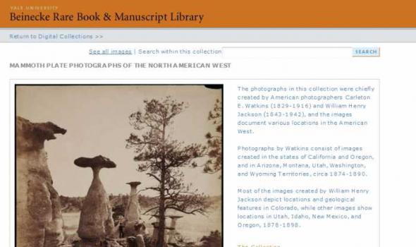
Mammoth plate photographs are photographic prints made through contact printing a photographic print from a large glass plate negative, usually 18 by 21 inches, but may vary in size from 15 by 18 inches to 22 by 25 inches. These large negatives allowed photographers to produce outsized photographic prints before the development of photographic enlargers. The collection consists of 57 black and white photographic prints roughly 21 x 17 inches Cite as: Mammoth Plate Photographs of the North American West. Yale Collection of Western Americana, Beinecke Rare Book and Manuscript Library. Call Number: WA Photos Folio 1

Welcome to the Digital Library for Earth System Education A free service Thank you for your interest in DLESE. This overview is intended to provide you with very general information about DLESE and the library's organization. As always, we welcome your comments and suggestions. Please direct them to support@dlese.org . Browse the Library resources and collections What is DLESE? DLESE is the Digital Library for Earth System Education, a free resource that supports teaching and learning about the Earth system. DLESE's development was funded by the National Science Foundation and continues to be built by a distributed community of educators, students, and scientists to support Earth system education at all levels.