Category: History & Historiography, Maps
Results

Search through one hundred maps, drawn from the Beinecke's vast collection of American and European cartography, depicting early representations of New England and North America. The Collection 100 maps, primarily woodcuts and printed engravings, from the Beinecke Library's Western Americana and General collections. Yale Collection of Western Americana, Beinecke Rare Book and Manuscript Library, Yale University
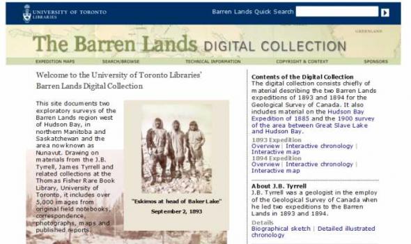
This site documents two exploratory surveys of the Barren Lands region west of Hudson Bay, in northern Manitoba and Saskatchewan and the area now known as Nunavut. Drawing on materials from the J.B. Tyrrell, James Tyrrell and related collections at the Thomas Fisher Rare Book Library, University of Toronto, it includes over 5,000 images from original field notebooks, correspondence, photographs, maps and published reports.

The Michigan County Histories and Atlases Digitization Project is comprised of 428 digitized titles (many composed of multiple volumes) published before 1923. The collection offers all members of the community free keyword searching and page-by-page access to digitized reproductions of Michigan county histories and atlases as a resource for historical and genealogical research. The collection is made possible, in part, through a generous Library Services and Technology Act (LSTA) grant. Additional funding was provided by Michigan Council of Library Directors institutions and a Michigan Digitization and Preservation for Access grant.