Category: Cartography
Results
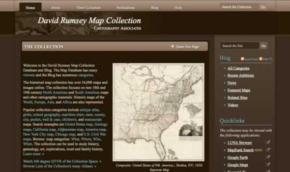
Welcome to the David Rumsey Map Collection Database and Blog. The Map Database has many viewers and the Blog has numerous categories . The historical map collection has over 34,000 maps and images online. The collection focuses on rare 18th and 19th century North American and South American maps and other cartographic materials. Historic maps of the World, Europe, Asia, and Africa are also represented.

Search through one hundred maps, drawn from the Beinecke's vast collection of American and European cartography, depicting early representations of New England and North America. The Collection 100 maps, primarily woodcuts and printed engravings, from the Beinecke Library's Western Americana and General collections. Yale Collection of Western Americana, Beinecke Rare Book and Manuscript Library, Yale University

Collections from the University of Alaska: Maps. The Rare Map Collection at the Rasmuson Library contains thousands of maps that document the history of Alaska, from 16th century speculative cartography to the gold rush era. This selection of maps provides basic coverage of the mapping of Alaska, from the early voyages of discovery through the sale of Russian America to the United States and the gold rush. The maps depict the growth of geographic knowledge that resulted from the great expeditions of the eighteenth and early nineteenth centuries,and also illustrate the carto-controversies that arose from various imagined geographies and fictitious voyages of discovery. A new map of the northeast coast of Asia, and the northwest coast of America, with the late Russian discoveries.
Bradford Washburn Photograph Collection The Bradford Washburn Collection The Alaska and Polar Regions Collections holds many of the more than 8,700 large format (8"x10") black-and-white negatives that Bradford Washburn created between 1937 and 1976. These are aerial images he took using methods that ranged from shooting photographs out the open door of a Bellanca Skyrocket with a modified Fairchild K-6 camera resting on his lap, to the use of a Learjet whose rear emergency window had been modified with a three-quarter inch optical glass photo-window. The University does not hold all of Washburn’s negatives. Some negatives remained with Washburn; others were sent to his authorized art gallery dealer: Panopticon . This gallery produces high-quality art images and posters.
DIGITAL COLLECTIONS by Tom Owen Historic maps attract inquiry on several levels. For some, they are works of art with color coding and linear preciseness. Early maps also reveal the limits of the known that the cartographer faced and the terrible limits on the information gathering techniques that were available to them. Indeed, maps are always a study in "looking through a glass darkly." Historic maps are a delightful testimony to the archetypal human need to know. As we look upon this collection of Kentucky maps we marvel at the intense curiosity about a single place - sometimes the tiniest place - that the map maker chose to record.
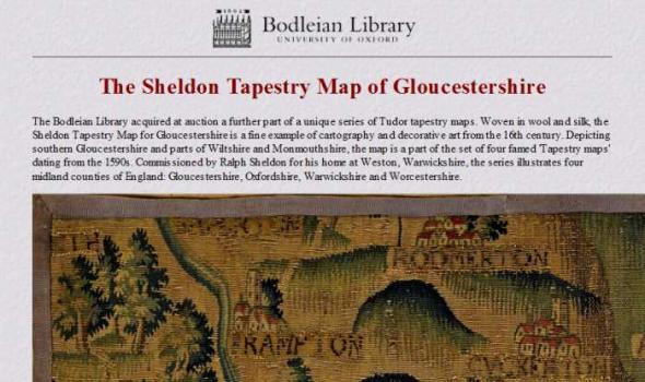
The Sheldon Tapestry Map of Gloucestershire The Bodleian Library acquired at auction a further part of a unique series of Tudor tapestry maps. Woven in wool and silk, the Sheldon Tapestry Map for Gloucestershire is a fine example of cartography and decorative art from the 16th century. Depicting southern Gloucestershire and parts of Wiltshire and Monmouthshire, the map is a part of the set of four famed 'Tapestry maps' dating from the 1590s. Commissioned by Ralph Sheldon for his home at Weston, Warwickshire, the series illustrates four midland counties of England: Gloucestershire, Oxfordshire, Warwickshire and Worcestershire.
The Printing House of the Family Blaeu: 17th Century Cartographic Printing from the Netherlands During the seventeenth century the people of the seventeen united provinces of the Netherlands experienced a period of tremendous economic prosperity. As a water-logged society with few land-based natural resources of their own, the Dutch developed into a highly efficient maritime culture that feverishly explored the globe to find goods that were in demand on the continental European market. Along with numerous advances in the fields of science, industry, business, and linguistics, the Dutch also became experts at book and cartographic printing.
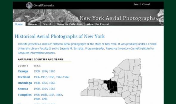
About the Project The Cornell Institute for Resource Information Sciences (IRIS) maintains a large and comprehensive collection of aerial photographs for New York State dating from 1936 through 1995. The archive numbers some 50,000 images that cover 48 counties, many counties of which have at least three years of historic sequence. The photographs are primarily black and white direct contact prints, and in hard copy form they measure from 7” x 9” to 9” x 9” in size; scales vary. Historic aerial photographs are valuable resources for landscape and land use analysis, assessment of environmental impacts, development projects and education.

This collection consists of digitally reproduced images of paper maps from the Cornell University Library's Map Collection. Included are maps from locations around the world, ranging in date from the nineteenth century to the present. While this collection will continue to grow, it will still only represent a fraction of the 300,000 maps, atlases, and other forms of geospatial data that make up the Map Collection. Located in Olin Library, the Map Collection is open to the public.
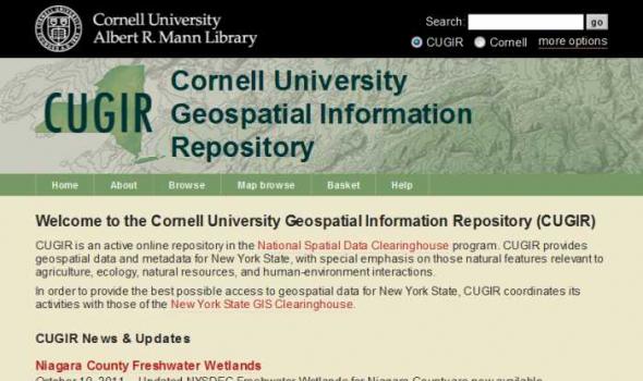
CUGIR: Cornell University Geospatial Information Repository About the Cornell University Geospatial Information Repository (CUGIR) CUGIR is an active online data and metadata repository and a participating node in the National Spatial Data Infrastructure program. CUGIR provides open and free access to geospatial data and metadata for New York State, with special emphasis on natural features relevant to agriculture, ecology, natural resources, and human-environment interactions. Subjects such as landforms and topography, soils, hydrology, environmental hazards, agricultural activities, wildlife and natural resource management are appropriate for inclusion in the CUGIR catalog.
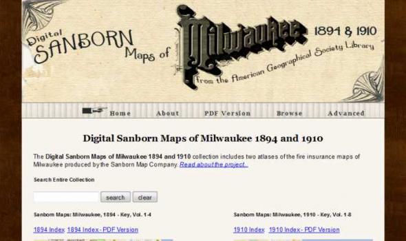
Scope and Content The Digital Sanborn Maps of Milwaukee 1894 & 1910 brings online 2 fire insurance atlases featuring detailed color maps of Milwaukee. Produced by the Sanborn Map Company, the 1894 atlas includes four volumes, consisting of 450 map sheets and the 1910 atlas includes eight volumes, consisting of 830 map sheets. Sanborn maps were designed to assist fire insurance agents with insuring property. Produced for over 12,000 urbanized areas in the United States, Sanborn maps have been described by the Library of Congress as "the single most important record of urban growth and development in the United States during the past one hundred years." Sanborn maps are excellent historical resources for academic, professional and personal needs.

The Michigan County Histories and Atlases Digitization Project is comprised of 428 digitized titles (many composed of multiple volumes) published before 1923. The collection offers all members of the community free keyword searching and page-by-page access to digitized reproductions of Michigan county histories and atlases as a resource for historical and genealogical research. The collection is made possible, in part, through a generous Library Services and Technology Act (LSTA) grant. Additional funding was provided by Michigan Council of Library Directors institutions and a Michigan Digitization and Preservation for Access grant.
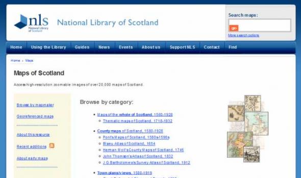
About 'Maps of Scotland' In our 'Maps of Scotland' resource you can access and view over 20,000 maps as high-resolution, colour, zoomable images. The maps date between 1560 and 1935 and we have grouped them into several categories. Browse by category The easiest way of finding material is to browse by category . The maps vary in the amount of detail they offer: You can also browse the maps by the names of map-makers, surveyors and engravers . Sets of county maps We have several altases online with sets of county maps : Military maps Another category is of maps made for military purposes , especially those from the 18th century. These include the famous Roy Military Survey of Scotland .

Project Background This Pilot Project was first conceived in May 1999 to provide Web access to high use maps from the University of California-Berkeley's Earth Sciences and Map Library's collection. One-time funds were requested and received from the Library's collections budget to cover scanning and other project costs. The U.S. Geological Survey's topographic quadrangles of the San Francisco Bay region were selected for digitizing. These maps are in the Public Domain and have no copyright restrictions, plus the geographic area selected would be a high use to our primary clientele and of interest for off-site users. Access is provided to both the 15- and 7.5-minute USGS topographic quadrangles, spanning more than 100 years of mapping (1885-1999). Geographic coverage extends from Pt.

The Mercator Globes Gerard Mercator was a publisher of maps and atlases but he also published two globes — the terrestrial globe of 1541 and the celestial globe of 1551. The globes were an instant commercial success and were the largest (42 cm) that had been produced to date. This online exhibit allows the viewer to study detailed images for each of the globes. The globes are now on permanent exhibit just outside of the entrance to the Map Collection in Pusey Library. Viewing Features of the Exhibition This exhibition offers a unique approach for viewing each globe.
The Harvard Map Collection is one of the oldest and largest collections of cartographic materials in the United States with over 500,000 items. Resources range from 16th century globes to modern maps and geographic information systems (GIS) layers. A selection of our materials has been digitally imaged and is offered both as true picture images and georeferenced copies. This Virtual Collection includes those maps and atlases that are available through the Harvard Image Delivery Service. Those maps that have been georeferenced are available through the Harvard Geospatial Library. Therefore, many of the maps listed will have two records, one for the image that is true to the original and the other a georeferenced image.